| Caution: The Internet is not part of the Maritime Safety Information's operational data stream and should never be relied upon as a means to obtain the latest forecast and warning information. Access to the Site may be interrupted or delayed from time to time, update may also experience occasional gaps. Please refer to OFFICIAL sources, Inmarsat SafetyNET or international NAVTEX services, for more complete information. |
METAREA XI/VIII_S/VIII_N/XI
| NAME | DATE |
|---|
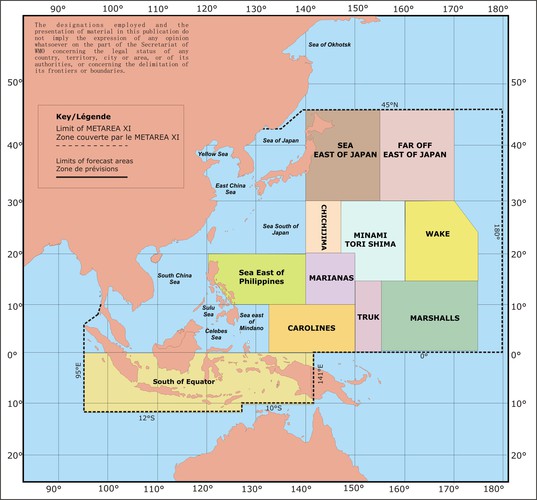
Sea regions: METAREA XI
Metarea map
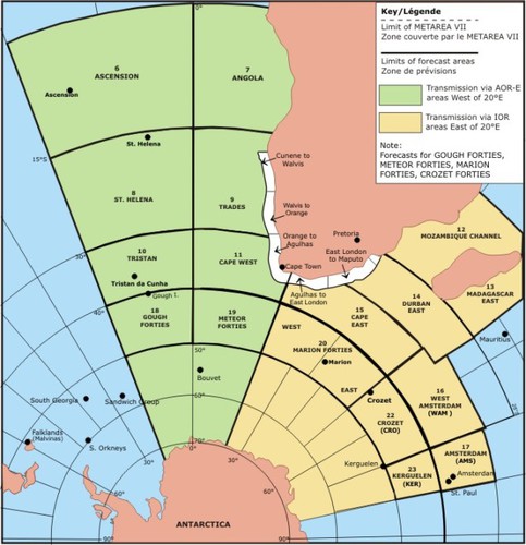
Sea regions: METAREA VIII_S
Metarea map

Sea regions: METAREA VIII_N
Metarea map
Sea regions: METAREA XI
Metarea map